2024 Map of O'Kean
USGS Topo · Published 2024About this map
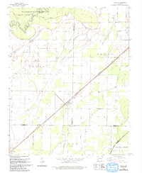
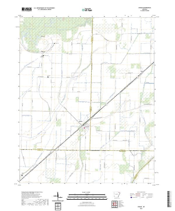
Village Creek and the Black River dominate this low-lying landscape where the boundaries of Randolph, Greene, and Lawrence counties converge. The drainage of the Arkansas Delta is clearly visible through an extensive system of man-made waterways, including Beaver Dam Ditch, Conley Ditch, and numerous numbered laterals like Lateral Number 10 and Lateral Number 9. These features reveal how the natural wetlands of Tupelo Slough and Grassy Slough have been historically managed for agriculture.
Find a feature on this map
80 named features on this map. Tap any name to fly to it.
Don’t see what you’re looking for? This feature index may not catch every label — zoom into the map to look around manually.
Map Details
Editions of this 2024 O'Kean Map
This is the sole edition of this map. No revisions or reprints were ever made.