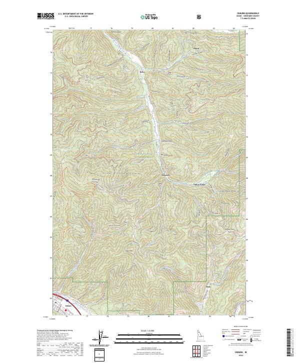
2024 Map of Osburn
USGS Topo · Published 2024About this map
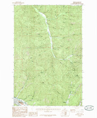
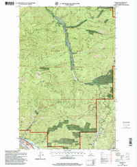
The town of Osburn sits along the southern edge of this map, established near the Interstate 90 corridor and Twomile Creek. This portion of the Coeur d'Alene National Forest is defined by a dense network of gulches and ridges that speak to the area's history of silver and lead prospecting. Smaller settlements like Delta and Ferguson are positioned along Beaver Creek, while the remote camp of Carbon Center is found further east near Carbon Creek. The landscape is dominated by the Coeur d'Alene Mountains, featuring prominent landmarks like Dago Peak and Browns Ridge. A sophisticated system of forest development roads and trails, such as the Evolution Trl and Scott Gulch-Ohv Trl, crisscrosses the terrain, following the natural paths carved by Ninemile Creek and numerous steep ravines like Placer Gulch and Keystone Gulch.
Find a feature on this map
76 named features on this map. Tap any name to fly to it.
Don’t see what you’re looking for? This feature index may not catch every label — zoom into the map to look around manually.
Map Details
Editions of this 2024 Osburn Map
This is the sole edition of this map. No revisions or reprints were ever made.
Historical Maps of Osburn Through Time
3 maps found