2022 Map of Pantego
USGS Topo · Published 2022About this map
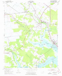
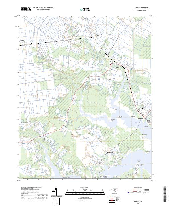
The coastal lowlands and winding creeks of Beaufort County define this landscape, where the waters of Pungo Creek and Broad Creek reach into the interior. The town of Belhaven serves as a primary hub on the eastern edge of the map, while Pantego sits further inland near the headwaters of the Broad Creek Canal. The terrain is marked by extensive drainage networks like Hell Swamp and Deep Run, and the shoreline is punctuated by numerous family-named points including Stotesberry Point, Fluhardt Point, and Spady Point.
Find a feature on this map
77 named features on this map. Tap any name to fly to it.
Don’t see what you’re looking for? This feature index may not catch every label — zoom into the map to look around manually.
Map Details
Editions of this 2022 Pantego Map
This is the sole edition of this map. No revisions or reprints were ever made.