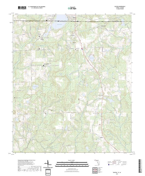
2024 Map of Paxton
USGS Topo · Published 2024About this map
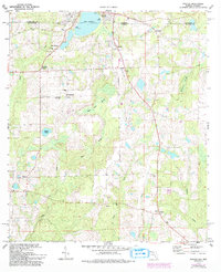
Britton Hill dominates the high ground in this corner of the Florida Panhandle, marking the highest natural point in the state near the Alabama border. The landscape is defined by the transition from the developed streets of Florala and Paxton to the dense drainage networks of Pine Log Creek and Turkey Creek. This area preserves a high density of rural genealogy markers, including the Clear Springs Community Cem and the J E Huckaba Cem, which reflect the generations of families settled across these sandy ridges and lowlands.
Find a feature on this map
98 named features on this map. Tap any name to fly to it.
Don’t see what you’re looking for? This feature index may not catch every label — zoom into the map to look around manually.
Map Details
Editions of this 2024 Paxton Map
This is the sole edition of this map. No revisions or reprints were ever made.