Loading...
Loading map...2024 Map of Pea Ridge
USGS Topo · Published 2024About this map
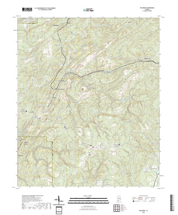
The Cahaba River winds through this section of central Alabama, marking a landscape defined by small mining-era settlements and scattered family burial grounds. Modern development around Helena and Brantleyville in the north contrasts with the more rural, creek-cut terrain to the south near the Bibb County line. Researchers will find numerous legacy locations such as Glen Carbon, Gurnee Junction, and Marvel, which speak to the industrial coal history of the Cahaba Basin.
Find a feature on this map
77 named features on this map. Tap any name to fly to it.
Don’t see what you’re looking for? This feature index may not catch every label — zoom into the map to look around manually.
Map Details
Date Portrayed2024
Date Published2024
PublisherU.S. Geological Survey
Map TypeTopographic
Scale1:24000
Physical Dimensions24 x 29 inches
Editions of this 2024 Pea Ridge Map
This is the sole edition of this map. No revisions or reprints were ever made.
Historical Maps of Tulse Through Time
Featured Locations
Source Details
SourceU.S. Geological Survey
CopyrightPublic Domain