2024 Map of Pineville
USGS Topo · Published 2024About this map
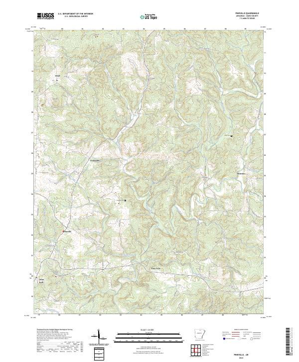
Pineville and the surrounding Izard County landscape are defined by a complex network of waterways and high ground in this contemporary survey. The terrain is marked by prominent features like Hively Mtn and the winding Dry Hollow, while the drainage system of Piney Creek, Little Brushy Creek, and Spring Creek dictates the layout of the local road network. Smaller communities and rural junctions such as Dolph, Wideman, Crossroads, and the uniquely named Forty Four are linked by backroads like Jackson Port Rd E and Old Dolph Rd. The map offers significant value for family history researchers, documenting precisely located burial sites including Potts Cem, Cresswell Cem, and Spring Creek Cem. To the southwest, the edge of Calico Rock appears, positioned near where Spring Creek and Bailey Creek converge, illustrating the enduring settlement patterns of this Ozark region.
Find a feature on this map
66 named features on this map. Tap any name to fly to it.
Don’t see what you’re looking for? This feature index may not catch every label — zoom into the map to look around manually.
Map Details
Editions of this 2024 Pineville Map
This is the sole edition of this map. No revisions or reprints were ever made.