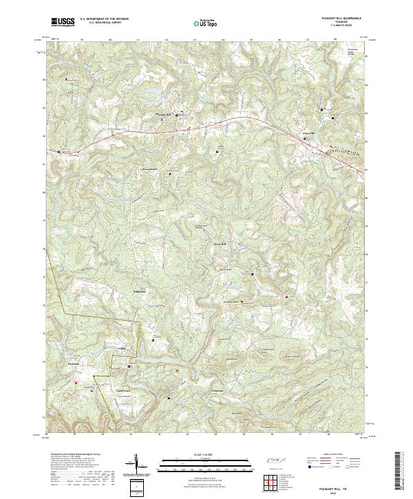
2022 Map of Pleasant Hill
USGS Topo · Published 2022About this map
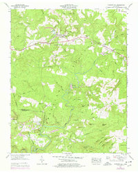
Pleasant Hill stands as the primary settlement on this portion of the Cumberland Plateau, where the Tennessee Valley Divide snakes across the northern highlands. The landscape is defined by the headwaters of the Caney Fork, with numerous hollows and knobs carving the terrain between White and Cumberland counties. This survey captures a mix of established community life and historical industrial footprints, most notably the Old Railroad Grade Rd running through the southwestern sector near Eastland and Clifty.
Find a feature on this map
134 named features on this map. Tap any name to fly to it.
Don’t see what you’re looking for? This feature index may not catch every label — zoom into the map to look around manually.
Map Details
Editions of this 2022 Pleasant Hill Map
This is the sole edition of this map. No revisions or reprints were ever made.