2024 Map of Ponce de Leon
USGS Topo · Published 2024About this map
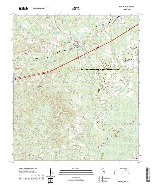
Ponce de Leon serves as the focal point of this Northwest Florida survey, situated where the historic Old Spanish Trl and Railroad St intersect the landscape. The geography is defined by an intricate network of karst features and waterways, notably the Ponce de Leon Spring and the Choctawhatchee River, which forms a significant boundary in the southern reach of the quadrangle. High ground is marked by named elevations such as Gopher Ridge and Sheep Hill, while the lowlands are saturated with numerous ponds and bays including Wolf Bay and Jack Bay.
Find a feature on this map
128 named features on this map. Tap any name to fly to it.
Don’t see what you’re looking for? This feature index may not catch every label — zoom into the map to look around manually.
Map Details
Editions of this 2024 Ponce de Leon Map
This is the sole edition of this map. No revisions or reprints were ever made.
Historical Maps of Knox Hill Through Time
1 maps found