2024 Map of Portal
USGS Topo · Published 2024About this map
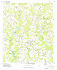
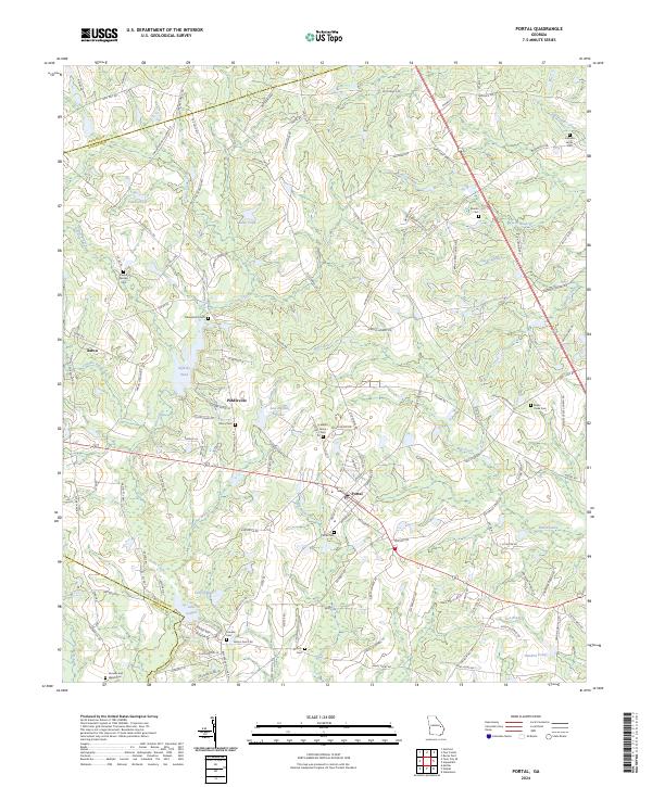
The town of Portal serves as a central hub for this rural stretch of Georgia, where the borders of Bulloch, Jenkins, and Candler counties meet. The landscape is defined by the winding course of Lotts Creek and its many tributaries, including Panther Branch and Big Branch. A distinct concentration of family and community burial sites such as Mincy Cem, Scarboro Grove Cem, and Portal Cem points to the deep generational roots of the local population. Small settlements like Piddleville and Aaron are linked by a network of established local routes including Old Portal Rd and Buttermilk Rd. Several significant water bodies, including Lanier Pond, Fields Pond, and Lake Collins, suggest a history of agricultural water management and recreation. The mapping of Banks Creek and Wyatts Branch further illustrates the complex drainage system feeding into the regional river basins.
Find a feature on this map
130 named features on this map. Tap any name to fly to it.
Don’t see what you’re looking for? This feature index may not catch every label — zoom into the map to look around manually.
Map Details
Editions of this 2024 Portal Map
This is the sole edition of this map. No revisions or reprints were ever made.