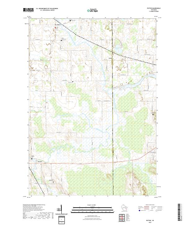
2022 Map of Potter
USGS Topo · Published 2022About this map
Potter and Hayton anchor a rural landscape defined by the winding paths of the Manitowoc River and its various branches. The area is marked by significant wetlands, most notably the expansive Hayton Marsh in the south and the corridors of the Killsnake River. This 2022 survey reveals a classic Wisconsin pattern of small, established hamlets connected by a grid of county roads such as Co Rd JJ and Co Rd Y. For genealogists and local historians, the map is particularly valuable for its documentation of numerous religious and community burial sites. These include the German Cem and Trinity Lutheran Cem near Potter, as well as the Saint Martin Catholic Cem and Hayton Hillside Cem further south. The distribution of these cemeteries alongside family-named roads like Schneider Rd and BrandES Rd provides a clear view of the ancestral footprint within Calumet and Manitowoc Counties.
Find a feature on this map
71 named features on this map. Tap any name to fly to it.
Don’t see what you’re looking for? This feature index may not catch every label — zoom into the map to look around manually.
Map Details
Editions of this 2022 Potter Map
This is the sole edition of this map. No revisions or reprints were ever made.
Other maps of this area

1954 · School Hill
USGS Topo · 1:24,000

1954 · Howards Grove
USGS Topo · 1:62,500

1954 · Chilton
USGS Topo · 1:62,500

1954 · Reedsville
USGS Topo · 1:62,500

1954 · Kiel
USGS Topo · 1:62,500

1954 · Milwaukee
USGS Topo · 1:250,000

1954 · Manitowoc
USGS Topo · 1:250,000

1955 · Green Bay
USGS Topo · 1:250,000

1957 · Madison
USGS Topo · 1:250,000

1958 · Manitowoc
USGS Topo · 1:250,000