Loading...
Loading map...2021 Map of Presho
USGS Topo · Published 2021About this map
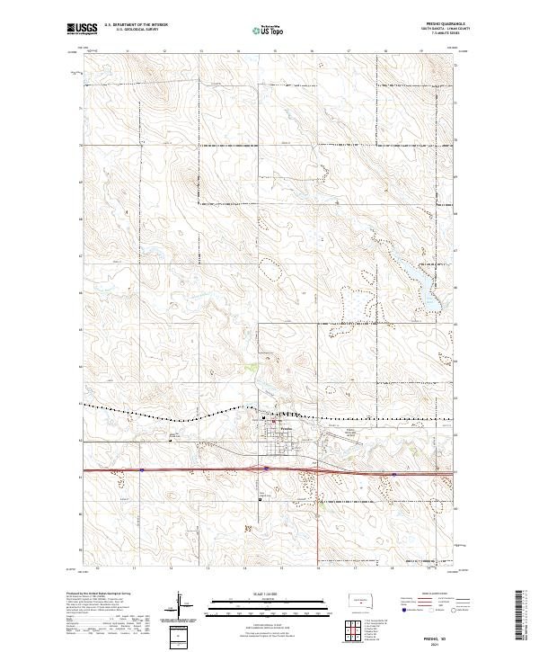
Presho sits at the heart of this Lyman County landscape, serving as a primary hub where the local road network, including CO Hwy 14 and Railroad St, converges. The town's layout is clearly defined by a grid of streets such as Main Ave and Birch Ave, bounded to the south by the modern corridor of Interstate 90. The surrounding prairie is drained by several waterways, most notably Medicine Cr and Stony Butte Cr, which wind through the open terrain of T105N and T106N.
Find a feature on this map
40 named features on this map. Tap any name to fly to it.
Don’t see what you’re looking for? This feature index may not catch every label — zoom into the map to look around manually.
Map Details
Date Portrayed2021
Date Published2021
PublisherU.S. Geological Survey
Map TypeTopographic
Scale1:24000
Physical Dimensions24 x 29 inches
Editions of this 2021 Presho Map
This is the sole edition of this map. No revisions or reprints were ever made.
Historical Maps of Presho Through Time
Featured Locations
Source Details
SourceU.S. Geological Survey
CopyrightPublic Domain