2022 Map of Preston
USGS Topo · Published 2022About this map
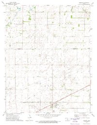
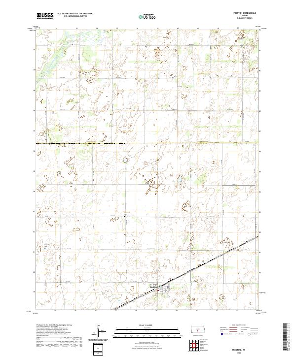
Preston serves as the primary hub of this agricultural landscape along the boundary of Stafford and Pratt Counties. The town's grid, featuring streets like Custer St and Thomas St, centers on a rail corridor that cuts diagonally through the southern plains. To the north, the small settlement of Neola sits near the headwaters of the N Fork Ninnescah River, while the southern reaches are drained by Silver Cr. Genealogists will find interest in the scattered burial grounds that speak to the area's pioneer history, specifically Haynesville Cem and Friendship Cem. The landscape is defined by a dense network of section-line roads, such as Co Rd B and Co Rd D, which organize the vast prairie into a precise grid of farmsteads and fields typical of the central Kansas wheat belt.
Find a feature on this map
40 named features on this map. Tap any name to fly to it.
Don’t see what you’re looking for? This feature index may not catch every label — zoom into the map to look around manually.
Map Details
Editions of this 2022 Preston Map
This is the sole edition of this map. No revisions or reprints were ever made.