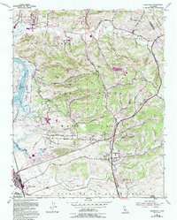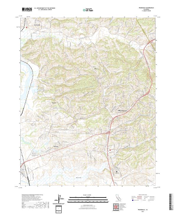
2021 Map of Prunedale
USGS Topo · Published 2021About this map
Prunedale and the surrounding canyons of northern Monterey County are defined by a complex network of coastal wetlands and ridges just inland from the Pacific. The landscape is carved by numerous drainages such as Strawberry Canyon, Paradise Canyon, and Langley Canyon, which flow toward the ecological crossroads of the Elkhorn Slough and Moro Cojo Slough. These tidal sloughs and the southern Tembladero Slough indicate the area's history as a low-lying drainage basin for the northern Salinas Valley.
Find a feature on this map
162 named features on this map. Tap any name to fly to it.
Don’t see what you’re looking for? This feature index may not catch every label — zoom into the map to look around manually.
Map Details
Editions of this 2021 Prunedale Map
This is the sole edition of this map. No revisions or reprints were ever made.