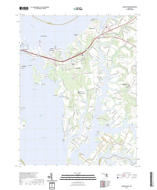
2023 Map of Queenstown
USGS Topo · Published 2023About this map
Queenstown and the surrounding inlets of the Chester River and Wye River define this deeply indented coastal landscape in Queen Anne’s County. The map details a complex network of maritime and overland routes, centered on the transition from Kent Island Narrows through Grasonville toward the eastern reaches. Local history is anchored by numerous community sites, including Bryan Methodist Church and John Wesley Church, each with their associated cemeteries. The intricate geography of the shoreline is particularly evident near Wye Island and Piney Neck, where small coves like Grapevine Cove and Salthouse Cove break the coastline. Further inland, smaller settlements like Perrys Corner and Carmichael are connected by rural corridors such as Wye Rd, illustrating the persistent agricultural and residential patterns of this Chesapeake Bay region.
Find a feature on this map
61 named features on this map. Tap any name to fly to it.
Don’t see what you’re looking for? This feature index may not catch every label — zoom into the map to look around manually.
Map Details
Editions of this 2023 Queenstown Map
This is the sole edition of this map. No revisions or reprints were ever made.
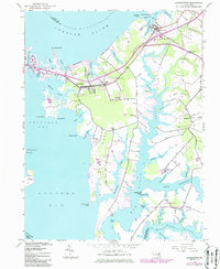
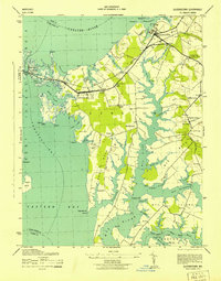
Historical Maps of Carmichael Through Time
3 maps found