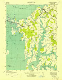
1943 Map of Queenstown
USGS Topo · Published 1943About this map
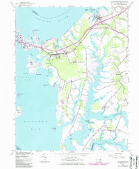
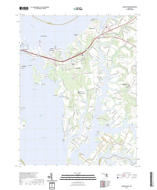
Queenstown and Grasonville anchor this 1940s coastal survey, revealing a landscape defined by the intricate tides of the Chester River and Eastern Bay. The era is marked by the operational Baltimore and Eastern railroad, which cuts through the heart of the peninsula, and a network of rural routes connecting small landings and church communities. Local heritage is deeply embedded in the map's labels, from the clustered headstones at St Peters Cem near St Peters Church to smaller landmarks like Bowser Chapel and Garnett Church. The shoreline is a jagged profile of points and coves, including Piney Neck Pt and Bluebeards Bluff, where the transition from agriculture to water-based industry is evident. On Wye Island and Piney Neck, scattered farmstead footprints and silos indicate the region's mid-century reliance on the fertile soil and the proximity of the Wye River.
Find a feature on this map
90 named features on this map. Tap any name to fly to it.
Don’t see what you’re looking for? This feature index may not catch every label — zoom into the map to look around manually.
Map Details
Editions of this 1943 Queenstown Map
This is the sole edition of this map. No revisions or reprints were ever made.
Historical Maps of Grasonville Through Time
7 maps found