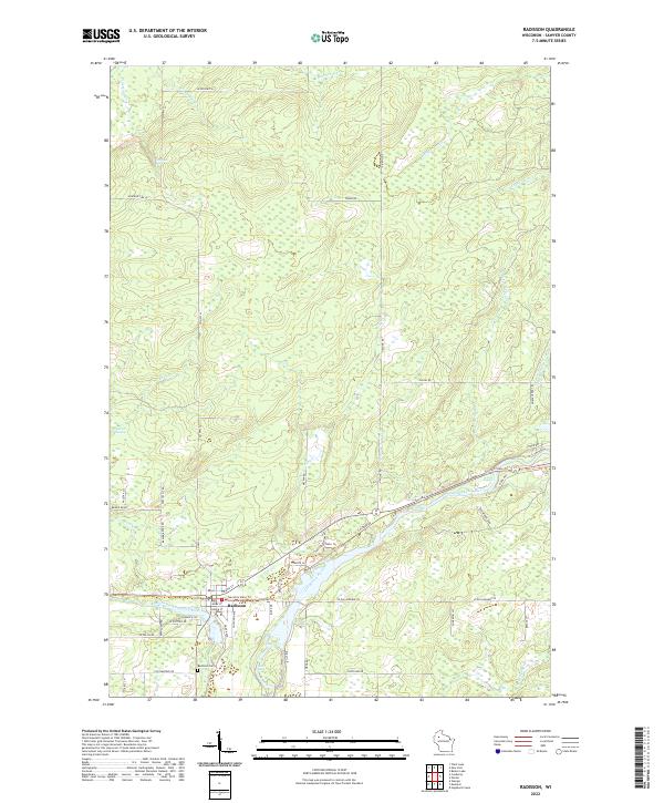
2022 Map of Radisson
USGS Topo · Published 2022About this map
Radisson serves as the primary hub on this Sawyer County landscape, situated where the Couderay River joins the larger Chippewa River drainage. The town's grid is clearly established, anchored by streets like Omaha St and Ogden Ave, with the Radisson Cem located to the southwest. The presence of the Tuscobia State Trl and Railroad Dr reflects the importance of transportation corridors in this region, following the natural path of the river valleys. Outside the settlement, the terrain is defined by numerous water features, including Pipestone Falls, Belille Falls, and the Crooked Rapids. Smaller drainages such as Blueberry Cr, Crazy Horse Cr, and Yankee Joe Cr cut through the timbered reaches, while Biernit Swamp marks the low-lying ground to the west, providing a detailed view of the Northwoods hydrology in the early 21st century.
Find a feature on this map
61 named features on this map. Tap any name to fly to it.
Don’t see what you’re looking for? This feature index may not catch every label — zoom into the map to look around manually.
Map Details
Editions of this 2022 Radisson Map
This is the sole edition of this map. No revisions or reprints were ever made.
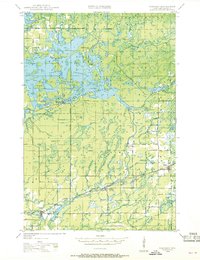
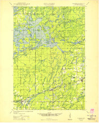
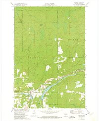
Historical Maps of Radisson Through Time
4 maps found