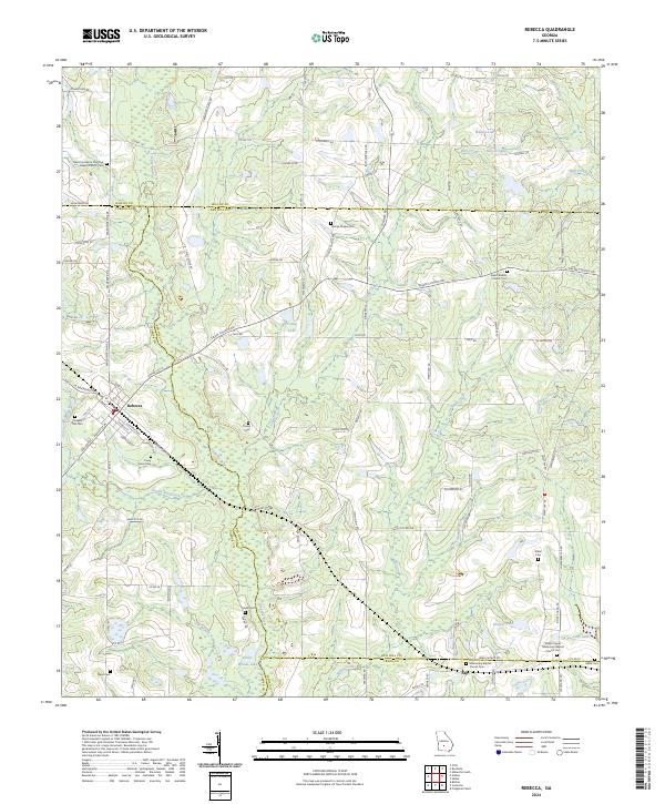
2024 Map of Rebecca
USGS Topo · Published 2024About this map
The town of Rebecca serves as a central hub on this South Georgia landscape, where the confluence of Turner, Wilcox, Ben Hill, and Irwin counties creates a complex jurisdictional boundary network. The upper reaches of the Alapaha River wind through the western portion of the terrain, flanked by numerous small water bodies such as Young Lake and Piney Woods Lake. This area is characterized by a dense concentration of rural spiritual and commemorative sites, reflecting a deep-rooted social history centered around community congregations. From the New Providence Primitive Baptist Church Cem in the northwest to Arp in the south, these locations define the historical geography of the region. The map reveals an intricate web of local roads, including Washington Ave and Sylvester Rd, which historically connected these remote farmsteads and churches to the rail lines passing through the heart of town.
Find a feature on this map
112 named features on this map. Tap any name to fly to it.
Don’t see what you’re looking for? This feature index may not catch every label — zoom into the map to look around manually.
Map Details
Editions of this 2024 Rebecca Map
This is the sole edition of this map. No revisions or reprints were ever made.
Other maps of this area

1953 · Waycross
USGS Topo · 1:250,000

1958 · Waycross
USGS Topo · 1:250,000

1973 · Irwinville
USGS Topo · 1:24,000

1973 · Bethel
USGS Topo · 1:24,000

1973 · Fitzgerald West
USGS Topo · 1:24,000

1974 · Rebecca
USGS Topo · 1:24,000
1974 · Abbeville South
USGS Topo · 1:24,000
1974 · Pitts
USGS Topo · 1:24,000

1974 · Amboy
USGS Topo · 1:24,000
1977 · Rochelle
USGS Topo · 1:24,000