2024 Map of Rena Lara
USGS Topo · Published 2024About this map
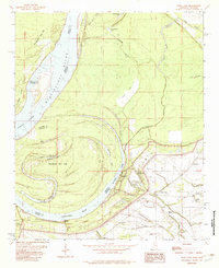
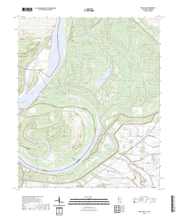
The Mississippi River defines the western edge of this landscape, carving a complex boundary between Mississippi and Arkansas. The terrain is shaped by the river's historical shifts, evidenced by prominent oxbows like Desoto Lake and wide chutes such as the Chute of Island. This delta region is characterized by a high density of water bodies, including Jim Samples Lake, Square Lake, and Blands Bayou, interspersed with low-lying wetlands like Lewis Swamp. Settlement is concentrated along the eastern corridor, where Rena Lara sits at the junction of local routes like Bobo Rena Lara Rd. The agricultural and drainage network is dominated by the Hushpuckena River and Hushpuckena Creek, which wind through the eastern flats near Green Grove and Walnut Grove. To the south, the community of Hillhouse serves as a waypoint near the massive Sunflower Bend.
Find a feature on this map
57 named features on this map. Tap any name to fly to it.
Don’t see what you’re looking for? This feature index may not catch every label — zoom into the map to look around manually.
Map Details
Editions of this 2024 Rena Lara Map
This is the sole edition of this map. No revisions or reprints were ever made.