Loading...
Loading map...2022 Map of Richmond
USGS Topo · Published 2022About this map
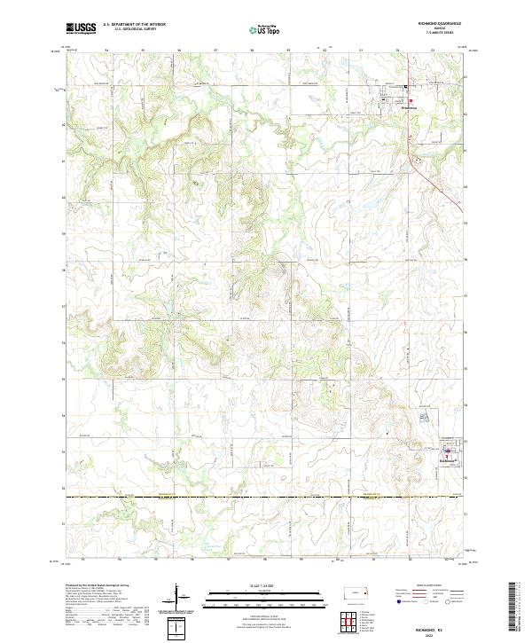
Richmond and Princeton anchor this rural landscape in Franklin County, where the topography is defined by the winding paths of Middle Cr and Payne Cr. The map reveals a highly structured grid of section lines and named thoroughfares, such as Eisenhower Rd and Louisiana Rd, which reflect the region's agricultural layout. A notable boundary between Franklin Co and Anderson Co runs across the southern portion of the sheet, marking the transition between jurisdictions.
Find a feature on this map
45 named features on this map. Tap any name to fly to it.
Don’t see what you’re looking for? This feature index may not catch every label — zoom into the map to look around manually.
Map Details
Date Portrayed2022
Date Published2022
PublisherU.S. Geological Survey
Map TypeTopographic
Scale1:24000
Physical Dimensions24 x 29 inches
Editions of this 2022 Richmond Map
This is the sole edition of this map. No revisions or reprints were ever made.
Historical Maps of Princeton Through Time
Featured Locations
Source Details
SourceU.S. Geological Survey
CopyrightPublic Domain