Loading...
Loading map...2024 Map of Rockville
USGS Topo · Published 2024About this map
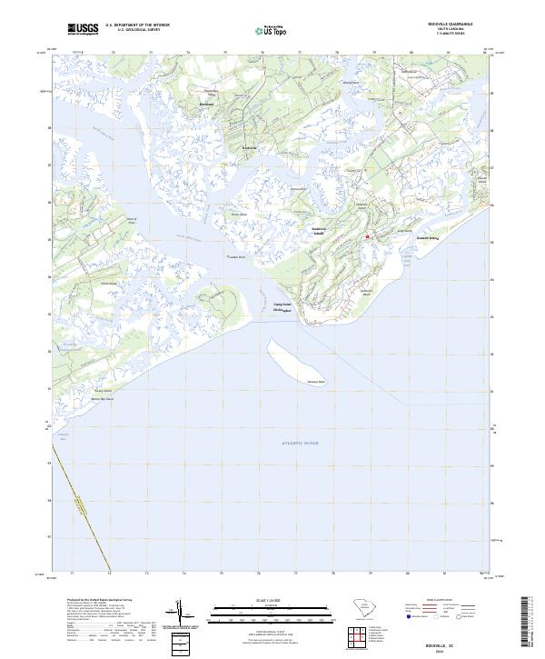
Wadmalaw Island and the surrounding Sea Islands define this coastal landscape, where the North Edisto River meets the Atlantic Ocean. The settlement of Rockville is positioned along the deep water of Bohicket Creek, a traditional center for maritime activity in the South Carolina Lowcountry. To the south and west, the map details the transition from the plantation lands of Edisto Island, including Point of Pines, to the barrier island developments of Seabrook Island and Kiawah Island.
Find a feature on this map
87 named features on this map. Tap any name to fly to it.
Don’t see what you’re looking for? This feature index may not catch every label — zoom into the map to look around manually.
Map Details
Date Portrayed2024
Date Published2024
PublisherU.S. Geological Survey
Map TypeTopographic
Scale1:24000
Physical Dimensions24 x 29 inches
Editions of this 2024 Rockville Map
This is the sole edition of this map. No revisions or reprints were ever made.
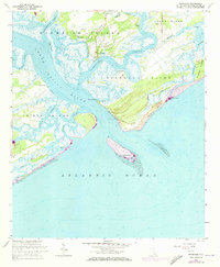
Historical Maps of Camp Saint Christopher Through Time
Featured Locations
Source Details
SourceU.S. Geological Survey
CopyrightPublic Domain