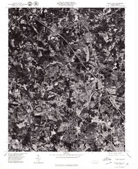
1977 Map of Rural Hall
USGS Topo · Published 1979About this map
Rural Hall and its surrounding communities are captured in this orthophotograph, providing a detailed visual record of North Carolina's Piedmont during the late 1970s. The imagery reveals the complex relationship between agricultural fields and the expanding suburban footprint north of Winston-Salem. Unlike traditional topographic maps, this aerial view shows the actual texture of the land, from the dense clusters of Tobaccoville to the historic settlement of Bethania. These settlements are connected by a growing network of roads and highways that cut through the patchwork of woods and farms. The aerial perspective is particularly useful for observing how established places like Peafftown and Stanleyville were evolving as the region's residential and industrial needs changed. Local features such as Alspaugh and the northern reaches of Reynolda further illustrate the transition from rural crossroads to integrated parts of the greater metropolitan landscape.
Find a feature on this map
7 named features on this map. Tap any name to fly to it.
Don’t see what you’re looking for? This feature index may not catch every label — zoom into the map to look around manually.
Map Details
Editions of this 1977 Rural Hall Map
This is the sole edition of this map. No revisions or reprints were ever made.
Other maps of this area

1950 · Winston-Salem West
USGS Topo · 1:24,000

1950 · Winston-Salem East
USGS Topo · 1:24,000

1951 · Winston-Salem West
USGS Topo · 1:24,000

1951 · Winston-Salem East
USGS Topo · 1:24,000

1951 · Rural Hall
USGS Topo · 1:24,000

1951 · Walkertown
USGS Topo · 1:24,000

1953 · Winston-Salem
USGS Topo · 1:250,000

1955 · Winston-Salem
USGS Topo · 1:250,000

1962 · Winston-Salem
USGS Topo · 1:250,000

1964 · Pinnacle
USGS Topo · 1:24,000