Loading...
Loading map...2024 Map of Ruskin
USGS Topo · Published 2024About this map
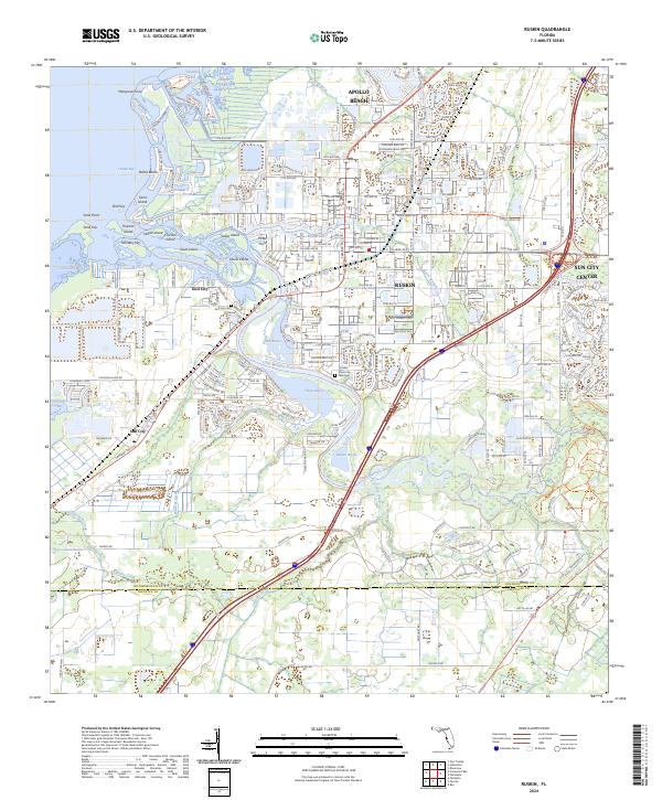
The Little Manatee River serves as a defining waterway for this coastal region, winding past the established communities of Ruskin and Sun City before reaching the shores of Tampa Bay. The landscape is a complex network of coastal inlets and named islands, including Goat Island, Snake Island, and Whiskey Key, all situated near the expansive Cockroach Bay aquatic preserve area.
Find a feature on this map
62 named features on this map. Tap any name to fly to it.
Don’t see what you’re looking for? This feature index may not catch every label — zoom into the map to look around manually.
Map Details
Date Portrayed2024
Date Published2024
PublisherU.S. Geological Survey
Map TypeTopographic
Scale1:24000
Physical Dimensions24 x 29 inches
Editions of this 2024 Ruskin Map
This is the sole edition of this map. No revisions or reprints were ever made.
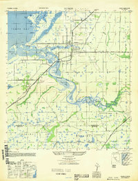
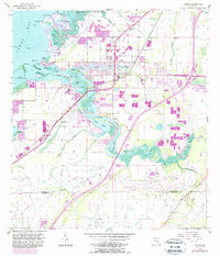
Historical Maps of Amanda Through Time
4 maps found

Featured Locations
Source Details
SourceU.S. Geological Survey
CopyrightPublic Domain