2022 Map of Salem
USGS Topo · Published 2022About this map
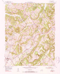
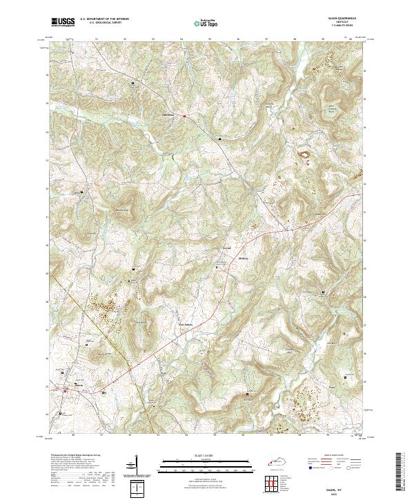
The border between Livingston Co and Crittenden Co bisects this landscape of ridges and hollows, where the rural settlements of Salem, New Salem, and Levias serve as historic anchors. The terrain is defined by distinctive high points like Hardin Knob and the Kirk Knobs, interspersed with numerous named bluffs such as John Thomas Bluff and Childress Bluff. This area preserves a high density of small family and community burial grounds, including the Mills Pioneer Cem and Butler Cem, which offer significant value for genealogical research. The presence of Crooked Spring and Crittenden Spring suggests the importance of natural water sources in the early development of these upland communities. Transportation follows the winding contours of the land, with routes like Siloem Church Rd and Levias Ridge Rd connecting the scattered farmsteads and rural chapels.
Find a feature on this map
108 named features on this map. Tap any name to fly to it.
Don’t see what you’re looking for? This feature index may not catch every label — zoom into the map to look around manually.
Map Details
Editions of this 2022 Salem Map
This is the sole edition of this map. No revisions or reprints were ever made.