2023 Map of San Luis
USGS Topo · Published 2023About this map
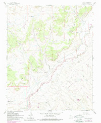
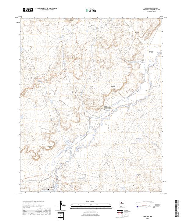
The settlement of San Luis sits along the winding course of the Rio Puerco, serving as a central point in this New Mexico landscape defined by mesas and arroyos. Historical sites like the La Sociedad de Nuestro Padre Jesus Nazareno de San Cem and the nearby San Luis Cem highlight the deep cultural and religious heritage of the area. To the south, the community of Cabezon lies near the Cabezon Cem, where the land is marked by traditional routes such as the Wagon Trail Trl and the modern Continental Divide National Scenic Trl. This survey captures the complex topography of high points like Mesa San Luis, Bosque Grande Mesa, and Angostura Hill. Numerous water management features, including Baño Tank and Alamito Tank Number Sixteen, reflect the essential efforts to manage resources across the arid terrain of Arroyo de los Cerros Colorados and Arroyo Balcon.
Find a feature on this map
34 named features on this map. Tap any name to fly to it.
Don’t see what you’re looking for? This feature index may not catch every label — zoom into the map to look around manually.
Map Details
Editions of this 2023 San Luis Map
This is the sole edition of this map. No revisions or reprints were ever made.