2024 Map of Sanford
USGS Topo · Published 2024About this map
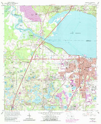
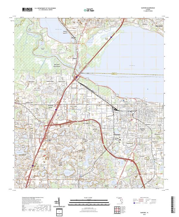
Lake Monroe and the Saint Johns River dominate the northern landscape of this region, serving as the historical and geographical anchor for numerous communities along their banks. The city of Sanford is densely mapped, showing a concentration of municipal and religious landmarks such as All Souls Catholic Cem and the Seminole Civil Justice Center. To the west, the transition from the river valley into upland areas is marked by distinct settlements like Sylvan Lake and Paola, alongside significant recreational and natural zones including the Wekiwa Wild and Scenic River. The map reveals an intricate network of transit and community history, from the Benson Junction rail point to the sprawling grounds of the Orlando Sanford International Airport. Modern trail systems like the Florida National Scenic Trail and Cross Seminole Trail now trace paths through historical neighborhoods such as New Upsala and Saint Josephs.
Find a feature on this map
85 named features on this map. Tap any name to fly to it.
Don’t see what you’re looking for? This feature index may not catch every label — zoom into the map to look around manually.
Map Details
Editions of this 2024 Sanford Map
This is the sole edition of this map. No revisions or reprints were ever made.