2022 Map of Santa Claus
USGS Topo · Published 2022About this map
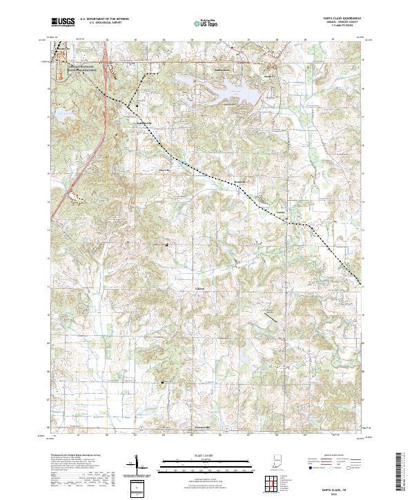
The Lincoln Boyhood National Memorial anchors the northwestern corner of this Spencer County landscape, preserving the area where the 16th president spent his formative years. To the east, the themed geography of Santa Claus is fully developed, featuring a network of holiday-inspired road names such as Sleigh Bell Dr, Prancer Dr, and Mistletoe Dr surrounding the waters of Christmas Lake and Lake Holly. The map illustrates a rural settlement pattern defined by small towns and family history, with several burial grounds including Buffaloville Cem, Tableman Cem, and Meeks Cem scattered among the drainage basins of Sandy Cr and Buckhorn Cr. Further south, the communities of Lamar, Liberal, and Newtonville are connected by a grid of county roads that traverse the agricultural and wooded terrain typical of Southern Indiana.
Find a feature on this map
101 named features on this map. Tap any name to fly to it.
Don’t see what you’re looking for? This feature index may not catch every label — zoom into the map to look around manually.
Map Details
Editions of this 2022 Santa Claus Map
This is the sole edition of this map. No revisions or reprints were ever made.