Loading...
Loading map...2023 Map of Saugatuck
USGS Topo · Published 2023About this map
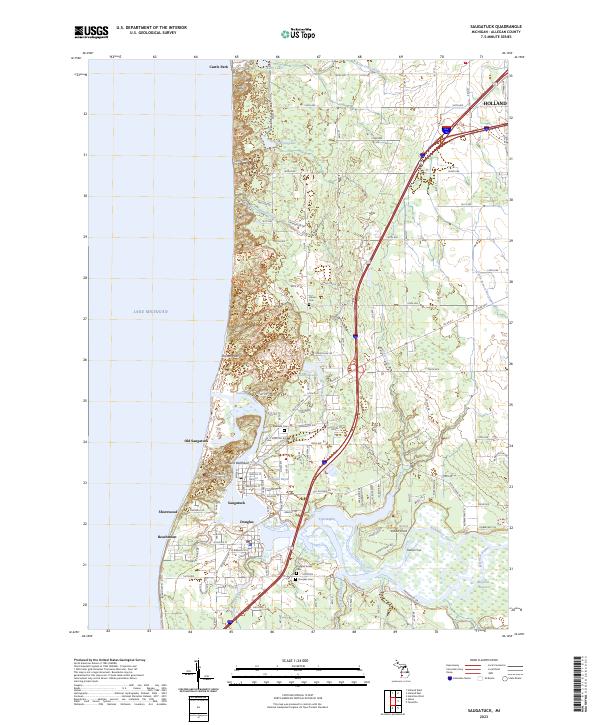
The Kalamazoo River winds toward Lake Michigan, defining the twin coastal communities of Saugatuck and Douglas. This modern survey details the intricate shoreline geography where the river meets the lake, featuring landmarks like Mount Baldhead and Pelican Peak. Along the river's path, distinctive waterways such as Douglas Bayou, Indian Cut, and Tyler Bayou illustrate the complex hydrography of this harbor region.
Find a feature on this map
75 named features on this map. Tap any name to fly to it.
Don’t see what you’re looking for? This feature index may not catch every label — zoom into the map to look around manually.
Map Details
Date Portrayed2023
Date Published2023
PublisherU.S. Geological Survey
Map TypeTopographic
Scale1:24000
Physical Dimensions24 x 29 inches
Editions of this 2023 Saugatuck Map
This is the sole edition of this map. No revisions or reprints were ever made.
Historical Maps of Douglas Through Time

Featured Locations
Source Details
SourceU.S. Geological Survey
CopyrightPublic Domain