2023 Map of Selah
USGS Topo · Published 2023About this map
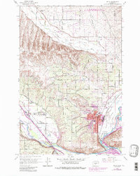
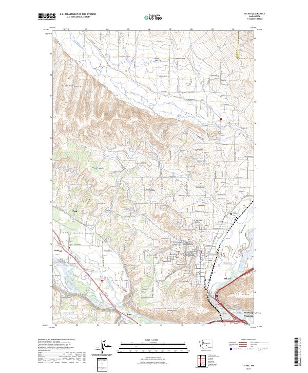
Wenas Mammoth Mtn and Yakima Ridge define the northern and eastern edges of this landscape, where the Naches River and Yakima River converge. The intricate network of irrigation features, including the Selah Valley Canal, Gleed Ditch, and Congdon Canal, illustrates the intensive agricultural development of the Lower Naches Valley. While the city of Selah serves as the primary population center, the map also captures smaller residential pockets like Gleed, Eschbach, and Brace. Local history is anchored at the Selah Pioneer Cem and family-named landmarks like Lookout Point. From the agricultural flats of Iowa Flat to the recreation-focused Rotary Lake, the map documents a region where water management has fundamentally reshaped the semi-arid terrain into a productive valley.
Find a feature on this map
174 named features on this map. Tap any name to fly to it.
Don’t see what you’re looking for? This feature index may not catch every label — zoom into the map to look around manually.
Map Details
Editions of this 2023 Selah Map
This is the sole edition of this map. No revisions or reprints were ever made.