2022 Map of Sheldon
USGS Topo · Published 2022About this map
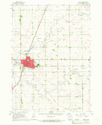
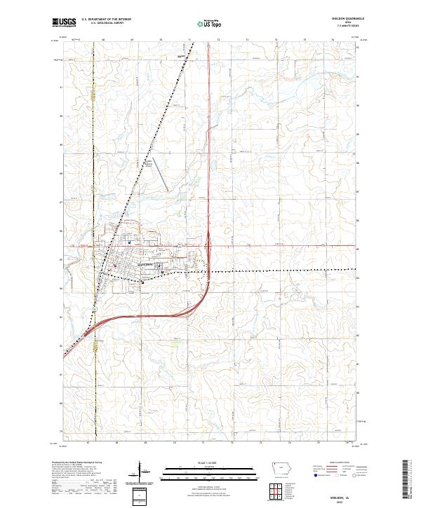
Sheldon serves as the primary hub of this landscape, situated at the border of Sioux and O'Brien counties. The town's grid is dense with street-level detail, including W Park St and Wyman St, while three significant cemeteries—East Lawn Cem, Saint Patricks Cem, and Saint Paul Lutheran Cem—sit on the eastern and southern fringes of the community. Outside the town limits, the topography is defined by the winding paths of the Floyd River and its various tributaries like Wolf Cr and Engels Cr. The northern settlement of Ritter stands as a smaller rail-aligned node in an area otherwise dedicated to a vast grid of county roads. The western edge of town is further marked by the Sheldon Regional Airport and the Sheldon Recreational Trl, which meanders along the river's path.
Find a feature on this map
37 named features on this map. Tap any name to fly to it.
Don’t see what you’re looking for? This feature index may not catch every label — zoom into the map to look around manually.
Map Details
Editions of this 2022 Sheldon Map
This is the sole edition of this map. No revisions or reprints were ever made.