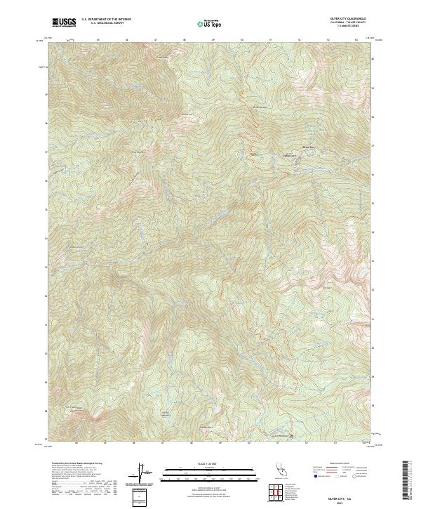
2023 Map of Silver City
USGS Topo · Published 2023About this map
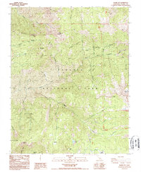
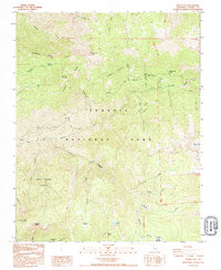
Silver City sits at the high-elevation reach of Mineral King Rd, serving as a small residential pocket surrounded by the expansive protected lands of Sequoia National Park. This portion of the Sierra Nevada is defined by the deep drainage of the East Fork Kaweah River, which is fed by numerous high-altitude streams such as Paradise Creek and Horse Creek. The map documents a transition from the structured street grid of Silver City, including Main St, to the primitive backcountry network of the John Krebs Wilderness and the Sequoia-Kings Canyon Wilderness. Notable landmarks like Homers Nose and Cahoon Rock overlook remote destinations such as Hockett Meadows and Cahoon Meadow. An extensive trail system, including the Atwell-Hockett Trl and Paradise Ridge Trl, provides the primary means of navigating this steep and complex terrain.
Find a feature on this map
50 named features on this map. Tap any name to fly to it.
Don’t see what you’re looking for? This feature index may not catch every label — zoom into the map to look around manually.
Map Details
Editions of this 2023 Silver City Map
This is the sole edition of this map. No revisions or reprints were ever made.
Historical Maps of Cabin Cove Through Time
3 maps found