2023 Map of Smithville Flats
USGS Topo · Published 2023About this map
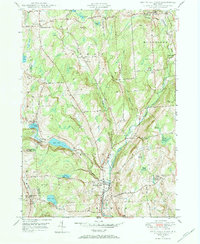
Smithville Flats and the village of McDonough anchor this topographic view of south-central New York, where the landscape is defined by the winding course of Genegantslet Creek. The area’s genealogical record is preserved across several rural burial grounds, including the Knickerbocker Cem, Westview Cem, and the Smithville Flats Cem. This survey illustrates a terrain of high ridges and narrow valleys, with numerous family-named summits like Meeker Hill, Keater Hill, and Winchell Hill rising between the drainages of Five Streams and Strongs Brook.
Find a feature on this map
104 named features on this map. Tap any name to fly to it.
Don’t see what you’re looking for? This feature index may not catch every label — zoom into the map to look around manually.
Map Details
Editions of this 2023 Smithville Flats Map
This is the sole edition of this map. No revisions or reprints were ever made.
Historical Maps of Cortland County Through Time
3 maps found