
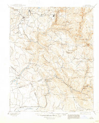
1893 Map of Sonora
USGS Topo · Published 1893About this map
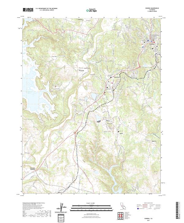
Sonora and its surrounding gold country are depicted here during the height of early California mining operations, long before modern damming altered the landscape. The geography is defined by the Tuolumne River and its major forks, where several early river crossings such as Ward Ferry and Moffat Bridge provided essential links between mining camps and emerging towns. This 1891 survey details the dense concentration of settlements including Jamestown, Chinese Camp, and Coulterville, which served as hubs for the region's extraction economy.
Find a feature on this map
135 named features on this map. Tap any name to fly to it.
Don’t see what you’re looking for? This feature index may not catch every label — zoom into the map to look around manually.
Map Details
Editions of this 1893 Sonora Map
This is the sole edition of this map. No revisions or reprints were ever made.
Historical Maps of Sonora Through Time
11 maps found
1893 Sonora
Tuolumne County, CA

1896 Sonora
Tuolumne County, CA
1897 Sonora
Tuolumne County, CA

1898 Sonora
Tuolumne County, CA
1948 Sonora
Tuolumne County, CA
1948 Sonora
Tuolumne County, CA
1949 Sonora
Tuolumne County, CA
2012 Sonora
Tuolumne County, CA
2015 Sonora
Tuolumne County, CA
2018 Sonora
Tuolumne County, CA
2021 Sonora
Tuolumne County, CA