2022 Map of South Mound
USGS Topo · Published 2022About this map
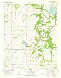
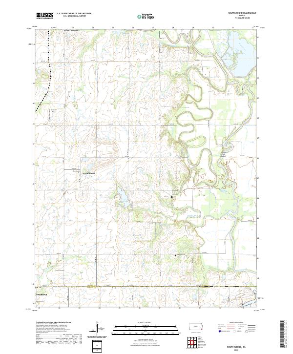
South Mound and the northern reaches of Parsons define the settlement pattern of this southeastern Kansas landscape at the border of Neosho and Labette counties. The eastern half of the map is dominated by the complex, tightly winding meanders of the Neosho River, where a series of sharp oxbows and the Neosho River Cutoff illustrate a highly active floodplain. This river system, fed by tributaries like Brogan Creek and Murphy Cr, contrasts with the high ground to the west, where Squadron Field and the small town of South Mound sit along a grid of section-line roads. Local genealogy is anchored by the presence of Oak Grove Cem and Brown Cem, while the industrial or recreational past is hinted at by Lake McKinley, reached via McKinley Lake Rd.
Find a feature on this map
40 named features on this map. Tap any name to fly to it.
Don’t see what you’re looking for? This feature index may not catch every label — zoom into the map to look around manually.
Map Details
Editions of this 2022 South Mound Map
This is the sole edition of this map. No revisions or reprints were ever made.