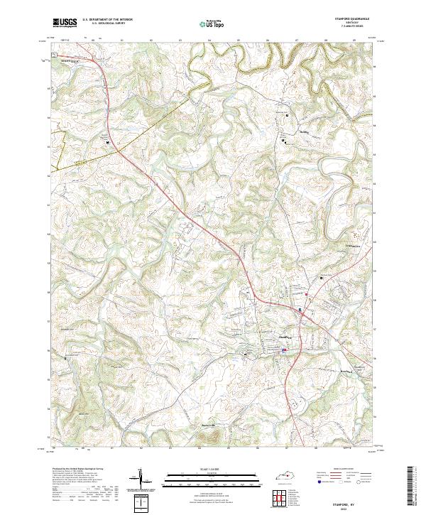
2022 Map of Stanford
USGS Topo · Published 2022About this map
Stanford serves as the focal point of this modern survey of the Bluegrass region, where the Lincoln County Judicial Center marks the civic heart of the area. The landscape is defined by the winding course of Hanging Fork Creek and the Dix River, which cut through the limestone terrain. To the southeast, the settlement of Rowland and the rise of Needmore Hill overlook the river valley, while the historic route of the Wilderness Trl provides a physical connection to the pioneer era of Kentucky's development.
Find a feature on this map
118 named features on this map. Tap any name to fly to it.
Don’t see what you’re looking for? This feature index may not catch every label — zoom into the map to look around manually.
Map Details
Editions of this 2022 Stanford Map
This is the sole edition of this map. No revisions or reprints were ever made.
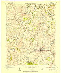
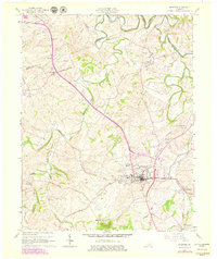
Historical Maps of Danville Through Time
3 maps found