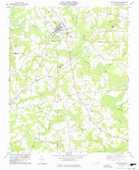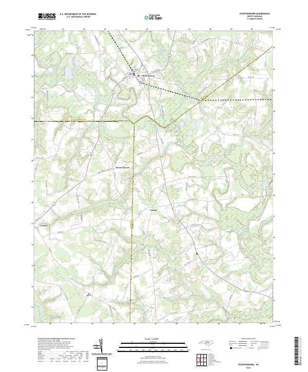
2022 Map of Stantonsburg
USGS Topo · Published 2022About this map
Stantonsburg serves as the primary hub in this corner of North Carolina, where the winding path of Contentnea Creek dictates the geography of the surrounding Wilson, Wayne, and Greene counties. The landscape is defined by its low-lying drainage networks, including Nahunta Swamp, Appletree Swamp, and Toisnot Swamp, which separate local settlements. Roadways such as Peacock Bridge Rd and Watery Branch Church Rd hint at the rural social structure, connecting smaller communities like Eureka, Lindell, and Faro across the marshy terrain.
Find a feature on this map
66 named features on this map. Tap any name to fly to it.
Don’t see what you’re looking for? This feature index may not catch every label — zoom into the map to look around manually.
Map Details
Editions of this 2022 Stantonsburg Map
This is the sole edition of this map. No revisions or reprints were ever made.