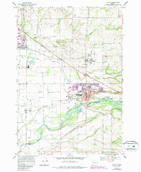
2023 Map of Stayton
USGS Topo · Published 2023About this map
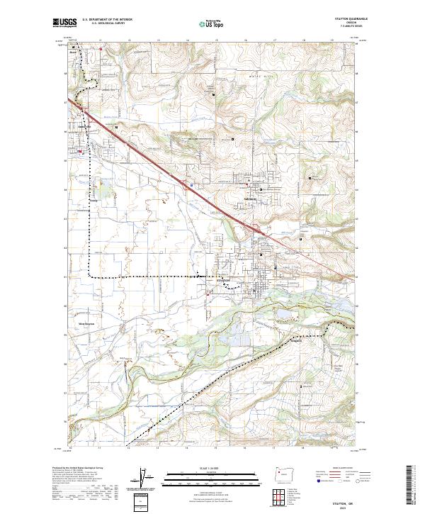
The Waldo Hills overlook a landscape defined by the North Santiam River and a sophisticated network of historical irrigation canals. In this modern survey of Marion and Linn counties, the towns of Stayton, Sublimity, and Aumsville appear as established hubs connected by the Cascade Hwy SE. The agricultural heritage of the region is evident in the presence of the Salem Ditch and Marion Ditch, which divert water from the North Santiam River near Geren Island to support the surrounding farmland. Genealogists will find this particular record invaluable, as it documents numerous burial sites including the Saint Boniface Old Cem, Saint Marys Cem, and several family-named plots like the Hobson - Whitney Cem. Smaller settlements like Kingston and West Stayton anchor the southern reaches of the quadrangle, while local airfields such as Hatch Airport and Lone Oaks Ranch Airport reflect the mix of rural and light industrial use.
Find a feature on this map
150 named features on this map. Tap any name to fly to it.
Don’t see what you’re looking for? This feature index may not catch every label — zoom into the map to look around manually.
Map Details
Editions of this 2023 Stayton Map
This is the sole edition of this map. No revisions or reprints were ever made.
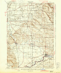
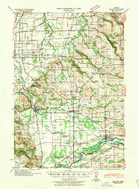
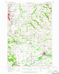
Historical Maps of Young Through Time
5 maps found