
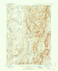
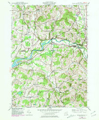
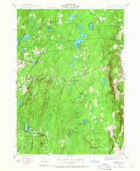
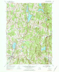
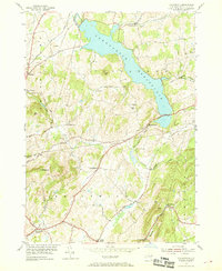
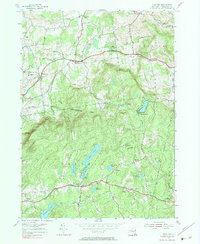
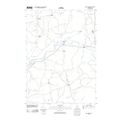
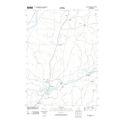
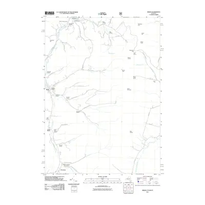
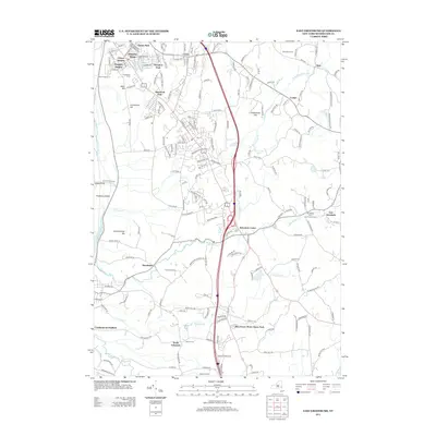
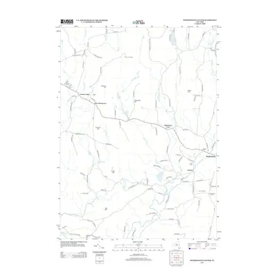
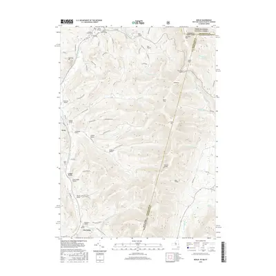
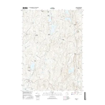
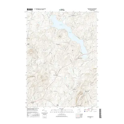
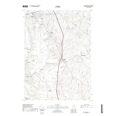
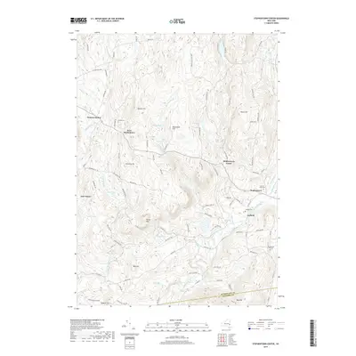
1988 Map of Stephentown Center
USGS Topo · Published 1988About this map
The Taconic Range and its complex topography dominate this late 1980s landscape at the New York and Massachusetts border. Small rural hamlets and agricultural pockets like Stephentown Center and West Stephentown are concentrated in the valley floors, while the steep ridgelines of Saddleback Ridge and Brodie Mtn remain largely forested. The map reveals a transition toward recreation-based land use, evidenced by the development of the Jiminy Peak Ski Area and Brodie Mtn Ski Area along the high eastern peaks.
Find a feature on this map
78 named features on this map. Tap any name to fly to it.
Don’t see what you’re looking for? This feature index may not catch every label — zoom into the map to look around manually.
Map Details
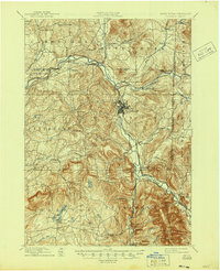
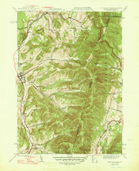
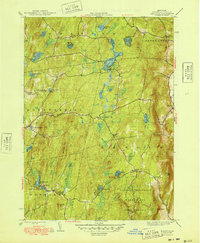
Editions of this 1988 Stephentown Center Map
This is the sole edition of this map. No revisions or reprints were ever made.
Historical Maps of Pittsfield Through Time
83 maps found
1888 Berlin
Rensselaer County, NY
1897 Hoosick
Rensselaer County, NY
1898 Berlin
Rensselaer County, NY
1900 Taconic
Rensselaer County, NY

1944 Berlin
Rensselaer County, NY
1944 Eagle Bridge
Rensselaer County, NY
1945 Stephentown Center
Rensselaer County, NY
1946 Eagle Bridge
Rensselaer County, NY
1946 Grafton
Rensselaer County, NY
1946 Taborton
Rensselaer County, NY

1947 Stephentown Center
Rensselaer County, NY
1948 Berlin
Rensselaer County, NY

1948 Stephentown Center
Rensselaer County, NY
1948 Taborton
Rensselaer County, NY

1950 Eagle Bridge
Rensselaer County, NY

1950 Taborton
Rensselaer County, NY
1953 East Greenbush
Rensselaer County, NY
1953 Nassau
Rensselaer County, NY
1953 Troy South
Rensselaer County, NY
1954 Grafton
Rensselaer County, NY
1954 Schaghticoke
Rensselaer County, NY
1954 Tomhannock
Rensselaer County, NY
1960 Berlin
Rensselaer County, NY
1973 Berlin
Rensselaer County, NY

1975 Berlin
Rensselaer County, NY
1978 East Greenbush
Rensselaer County, NY
1978 Grafton
Rensselaer County, NY
1978 Troy South
Rensselaer County, NY

1988 Berlin
Rensselaer County, NY
1988 Stephentown Center
Rensselaer County, NY
1997 Berlin
Rensselaer County, NY
1998 Berlin
Rensselaer County, NY

1998 Stephentown Center
Rensselaer County, NY
2010 Eagle Bridge
Rensselaer County, NY
2010 East Greenbush
Rensselaer County, NY
2010 Grafton
Rensselaer County, NY
2010 Nassau
Rensselaer County, NY
2010 Schaghticoke
Rensselaer County, NY
2010 Stephentown Center
Rensselaer County, NY
2010 Taborton
Rensselaer County, NY
2010 Tomhannock
Rensselaer County, NY
2011 Berlin
Rensselaer County, NY
2011 Troy South
Rensselaer County, NY
2013 Berlin
Rensselaer County, NY
2013 Eagle Bridge
Rensselaer County, NY
2013 East Greenbush
Rensselaer County, NY
2013 Grafton
Rensselaer County, NY
2013 Nassau
Rensselaer County, NY
2013 Schaghticoke
Rensselaer County, NY
2013 Stephentown Center
Rensselaer County, NY
2013 Taborton
Rensselaer County, NY
2013 Tomhannock
Rensselaer County, NY
2013 Troy South
Rensselaer County, NY
2016 Berlin
Rensselaer County, NY
2016 Eagle Bridge
Rensselaer County, NY
2016 East Greenbush
Rensselaer County, NY
2016 Grafton
Rensselaer County, NY
2016 Nassau
Rensselaer County, NY
2016 Schaghticoke
Rensselaer County, NY
2016 Stephentown Center
Rensselaer County, NY
2016 Taborton
Rensselaer County, NY
2016 Tomhannock
Rensselaer County, NY
2016 Troy South
Rensselaer County, NY
2019 Berlin
Rensselaer County, NY
2019 Eagle Bridge
Rensselaer County, NY
2019 East Greenbush
Rensselaer County, NY
2019 Grafton
Rensselaer County, NY
2019 Nassau
Rensselaer County, NY
2019 Schaghticoke
Rensselaer County, NY
2019 Stephentown Center
Rensselaer County, NY
2019 Taborton
Rensselaer County, NY
2019 Tomhannock
Rensselaer County, NY
2019 Troy South
Rensselaer County, NY

2023 Berlin
Rensselaer County, NY

2023 Eagle Bridge
Rensselaer County, NY

2023 East Greenbush
Rensselaer County, NY

2023 Grafton
Rensselaer County, NY

2023 Nassau
Rensselaer County, NY

2023 Schaghticoke
Rensselaer County, NY

2023 Stephentown Center
Rensselaer County, NY

2023 Taborton
Rensselaer County, NY

2023 Tomhannock
Rensselaer County, NY

2023 Troy South
Rensselaer County, NY