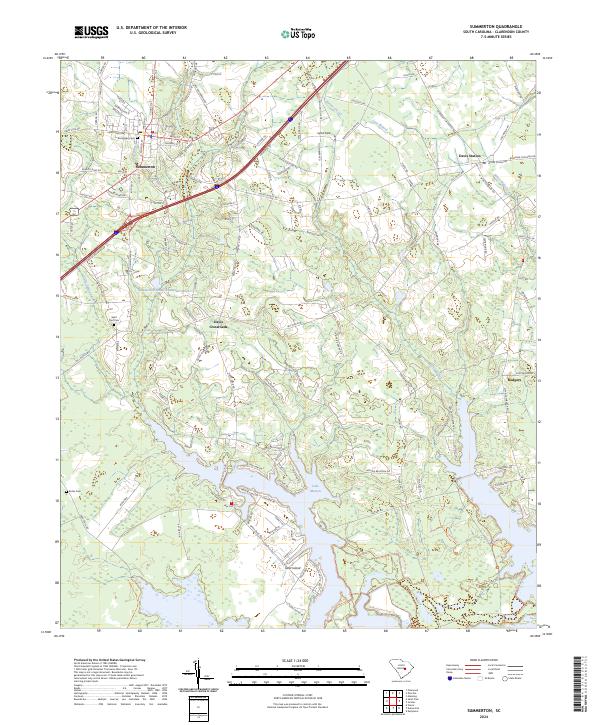
2024 Map of Summerton
USGS Topo · Published 2024About this map
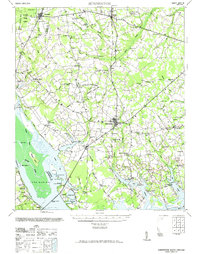
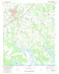
Summerton serves as the primary hub of this Clarendon County landscape, where the street grid transitions into a network of rural roads and family-named landmarks. The map documents the northern reaches of Lake Marion, where the waters meet the Santee National Wildlife Refuge and the intricate channels of Taw Caw Creek. Local history and genealogy are anchored by several burial grounds, including Evergreen Cem, Saint Paul Cem, and Butler Cem, which sit alongside established settlements like Davis Crossroads and Davis Station. The geography is defined by its relationship with the water, featuring prominent landforms like Goat Island and the wooded expanses of Spirit Field. This map illustrates the modern footprint of these communities as they are woven between the sprawling reservoir and protected wetlands, preserving the names of old routes like Larry King Hwy and Annie Tindal Rd.
Find a feature on this map
136 named features on this map. Tap any name to fly to it.
Don’t see what you’re looking for? This feature index may not catch every label — zoom into the map to look around manually.
Map Details
Editions of this 2024 Summerton Map
This is the sole edition of this map. No revisions or reprints were ever made.
Historical Maps of Davis Crossroads Through Time
3 maps found