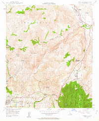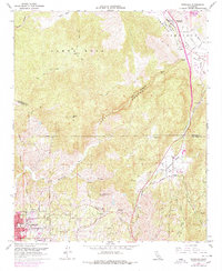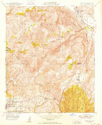
1950 Map of Temecula
USGS Topo · Published 1950About this map
Temecula and the Temecula Valley are shown here during a period of transition as the region's agricultural roots remained centered on family ranches and small settlements. The Temecula River and Santa Margarita River carve through the foothills of the Santa Rosa range, providing a corridor for early development between Riverside and San Diego counties. At this time, infrastructure was light but critical, marked by the Aqueduct crossing through the southern portion of the sheet and a lookout atop Red Mountain.
Find a feature on this map
39 named features on this map. Tap any name to fly to it.
Don’t see what you’re looking for? This feature index may not catch every label — zoom into the map to look around manually.
Map Details
Editions of this 1950 Temecula Map
This is the sole edition of this map. No revisions or reprints were ever made.
Historical Maps of Temecula Through Time
8 maps found