2021 Map of Templeton
USGS Topo · Published 2021About this map
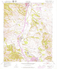
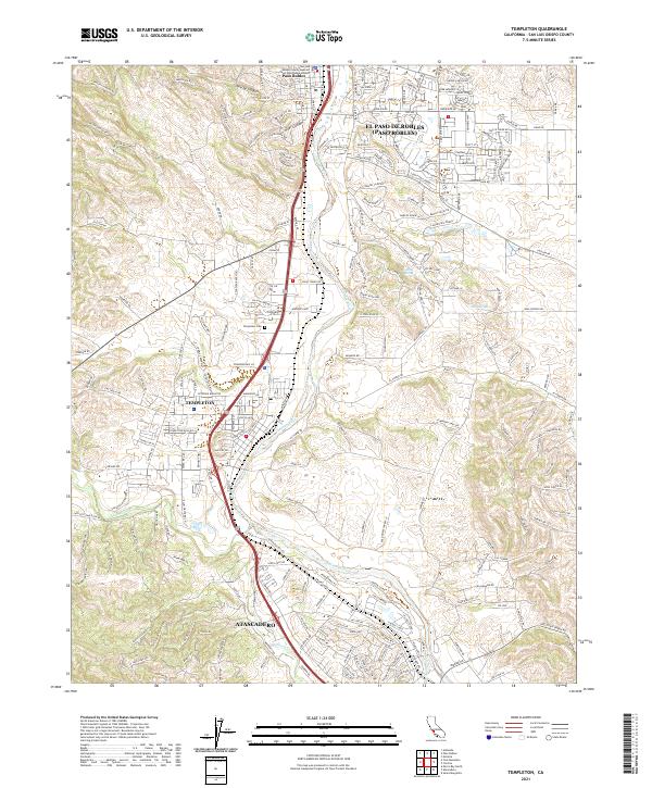
The Salinas River corridor defines the geography of this San Luis Obispo County survey, tracing a path through the burgeoning communities of Templeton, Atascadero, and Paso Robles. The Union Pacific railroad line mirrors the river's course, a testament to the enduring influence of the iron rail on Central Coast development. While residential growth is evident near the municipal centers, the surrounding hillsides remain characterized by steep drainages like Kiler Canyon and agricultural tracts. Local history is anchored by sites such as the Templeton Cem, which overlooks the valley. The map also records numerous water sources vital to this Mediterranean climate, including Neals Spring, Sulphur Spring, and the winding Paso Robles Cr, which feeds into the primary river system near the northern edge of the quadrangle.
Find a feature on this map
239 named features on this map. Tap any name to fly to it.
Don’t see what you’re looking for? This feature index may not catch every label — zoom into the map to look around manually.
Map Details
Editions of this 2021 Templeton Map
This is the sole edition of this map. No revisions or reprints were ever made.