2022 Map of Thorp
USGS Topo · Published 2022About this map
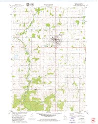
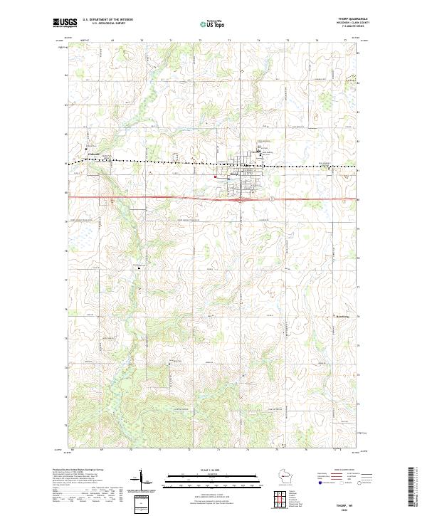
The city of Thorp serves as the central hub of this 2022 survey, showcasing the street grid of the community including W Birch St and E Main St. To the west, the smaller settlement of Eidsvold sits near the winding course of the North Fork Eau Claire River, with the North Fork Airport nearby. The landscape is characterized by a strong agricultural and religious heritage, evident in the numerous namesake burial grounds such as Germanian Cem, Norwegian Cem, and both the Saint Hedwig New Cem and Saint Hedwig Old Cem. Cultural landmarks like Saint Bernard Ch stand as anchors for the local community. The drainage of the region is defined by several waterways, including McGrogan Cr, Goggle-Eye Cr, and Sterling Cr, which carve through the townships and sections of Clark County.
Find a feature on this map
59 named features on this map. Tap any name to fly to it.
Don’t see what you’re looking for? This feature index may not catch every label — zoom into the map to look around manually.
Map Details
Editions of this 2022 Thorp Map
This is the sole edition of this map. No revisions or reprints were ever made.