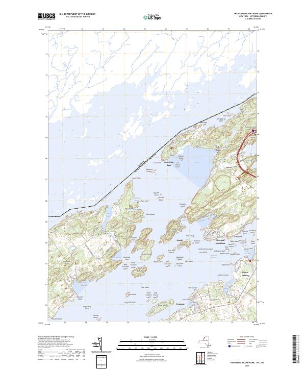
2023 Map of Thousand Island Park
USGS Topo · Published 2023About this map
The Saint Lawrence River serves as the international boundary and primary corridor for this riverine landscape, where the United States-Canada border threads through a dense archipelago. High-density Victorian-era resort planning is evident at Thousand Island Park, characterized by a grid of narrow streets like Oak St and Central Ave leading toward the American Narrows. The map highlights the complex relationship between land and water, showing significant island masses such as Grindstone Island and the expansive Wellesley Island State Park. Local life centers on the water's edge at Fishers Landing and Fineview, where the shoreline is punctuated by family-named landmarks and distinct clusters like the Eagle Wing Group and the Robinson Group. This contemporary survey details the modern infrastructure of the region, including County Road 191 and the winding Nature Center Rd, while preserving the names of historic bays like Delaney Bay and Aunt Janes Bay.
Find a feature on this map
107 named features on this map. Tap any name to fly to it.
Don’t see what you’re looking for? This feature index may not catch every label — zoom into the map to look around manually.
Map Details
Editions of this 2023 Thousand Island Park Map
This is the sole edition of this map. No revisions or reprints were ever made.
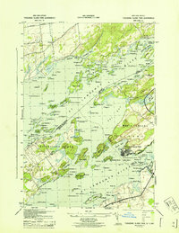
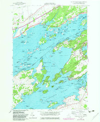
Historical Maps of Fineview Through Time
3 maps found