2021 Map of Thurston
USGS Topo · Published 2021About this map
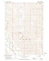
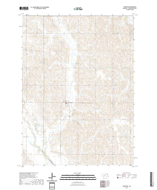
Thurston serves as the central hub of this agricultural landscape in northeast Nebraska, where the terrain is defined by a dense network of watercourses and section-line roads. The drainage patterns here are particularly noteworthy, featuring the Logan Creek Dredge and the winding Old Channel Logan Creek, illustrating the history of hydraulic engineering and land reclamation in the region. These waterways, including Middle Creek and Rattlesnake Creek, carve through the rolling loess hills, influencing the layout of local infrastructure like Lemmon Ave and Sand Drive. In the southern portion of the map, the Logan Creek Trail follows a former railroad corridor, preserving a vital link to the era of steam-powered transit. Researchers can trace the legacy of rural development through the established grid of arterial routes such as The Strip Rd and the various numbered roads like 17 Rd that segment the productive farmlands.
Find a feature on this map
27 named features on this map. Tap any name to fly to it.
Don’t see what you’re looking for? This feature index may not catch every label — zoom into the map to look around manually.
Map Details
Editions of this 2021 Thurston Map
This is the sole edition of this map. No revisions or reprints were ever made.