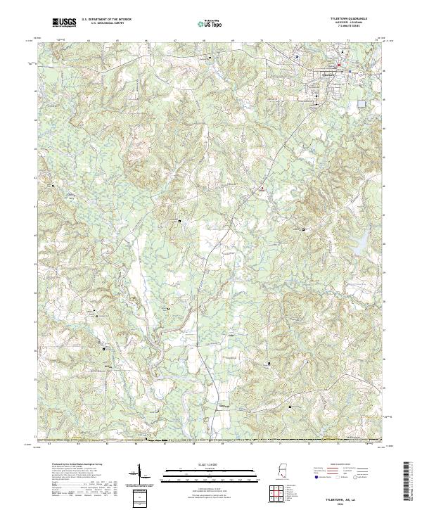
2024 Map of Tylertown
USGS Topo · Published 2024About this map
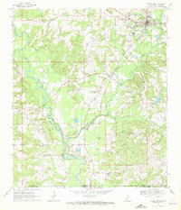
Tylertown serves as the focal point of this Walthall County landscape, where the Walthall County Courthouse and Tylertown High School anchor the local community. The town is situated near the confluence of several significant waterways, including Magees Creek and Dry Creek, which feed into the larger river systems of the region. This 2024 survey documents a network of rural settlements like Lexie, Lehr, and Dillon, connected by numerous family-named roads such as Claude Smith Rd and Maggie Johnson Rd.
Find a feature on this map
119 named features on this map. Tap any name to fly to it.
Don’t see what you’re looking for? This feature index may not catch every label — zoom into the map to look around manually.
Map Details
Editions of this 2024 Tylertown Map
This is the sole edition of this map. No revisions or reprints were ever made.