2023 Map of Utica
USGS Topo · Published 2023About this map
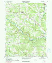
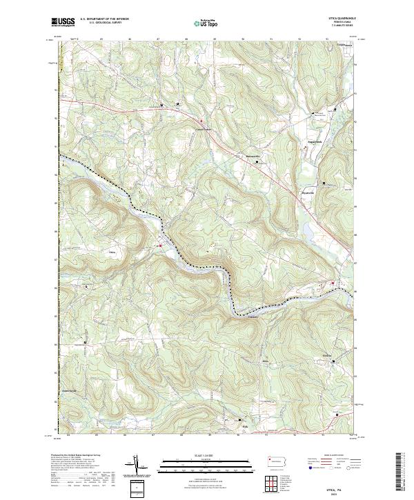
French Creek winds through the heart of this Venango County landscape, serving as a central artery for small communities like Utica and Takitezy. The area's settlement pattern is defined by the rugged topography of the Allegheny Plateau, where towns such as Polk and Sugarcreek occupy the narrow valley floors. Long-standing family and community ties are evident in the high density of burial grounds, including the Millcreek Cem and Sugarcreek Memorial Cem, which dot the hillsides overlooking the creek's many bends.
Find a feature on this map
56 named features on this map. Tap any name to fly to it.
Don’t see what you’re looking for? This feature index may not catch every label — zoom into the map to look around manually.
Map Details
Editions of this 2023 Utica Map
This is the sole edition of this map. No revisions or reprints were ever made.