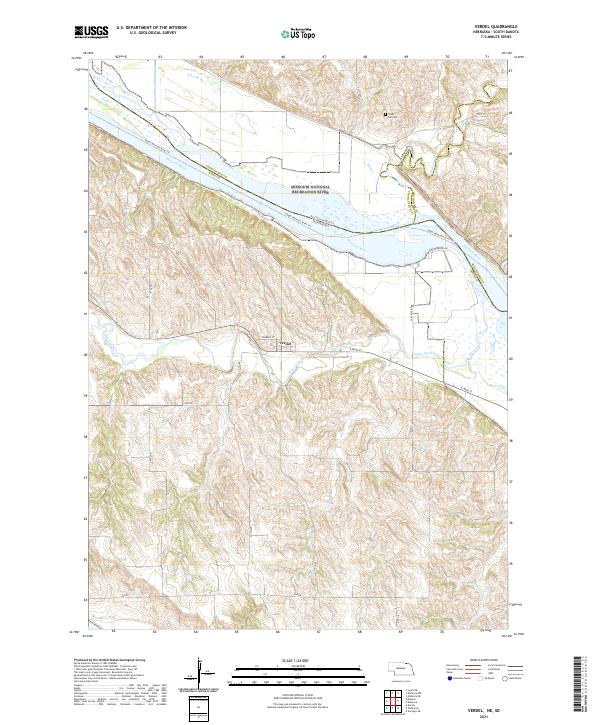
2021 Map of Verdel
USGS Topo · Published 2021About this map
The Missouri River defines the northern reach of this quadrangle, where the Missouri National Recreation River and Missouri Wild and Scenic River overlap near the confluence of Bull Creek and Chateau Creek. In this riverine landscape, the Upper Missouri River Trail follows the water’s edge along the border between Nebraska and South Dakota. The village of Verdel serves as the primary settlement on the Nebraska side, situated near the meandering path of Ponca Creek. South of the river, the land rises into a complex network of drainage basins, including Dewey Creek and Harry Miller Creek, reflecting the traditional township-and-range division of the American West. Local history is anchored by sites like Cedar Hill Cemetery in the north, providing a tangible connection for genealogists tracing early families in Knox County.
Find a feature on this map
35 named features on this map. Tap any name to fly to it.
Don’t see what you’re looking for? This feature index may not catch every label — zoom into the map to look around manually.
Map Details
Editions of this 2021 Verdel Map
This is the sole edition of this map. No revisions or reprints were ever made.
Other maps of this area

1950 · Niobrara
USGS Topo · 1:24,000

1950 · Verdel
USGS Topo · 1:24,000

1950 · Verdigre NE
USGS Topo · 1:24,000

1950 · Pishelville
USGS Topo · 1:24,000

1950 · Monowi
USGS Topo · 1:24,000

1952 · Monowi
USGS Topo · 1:24,000

1952 · Dorsey
USGS Topo · 1:24,000

1955 · O'Neill
USGS Topo · 1:250,000

1959 · O'Neill
USGS Topo · 1:250,000

1964 · Lynch NE
USGS Topo · 1:24,000