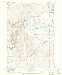
1967 Map of Vines Hill
USGS Topo · Published 1971About this map
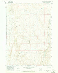
The Malheur River cuts a deep Canyon through the high desert of eastern Oregon in this late-1960s survey. The landscape is defined by the complex water engineering required for agriculture in this arid environment, featuring an extensive network of irrigation works including the Vale Oregon Canal, Farmers Ditch, and the J-H Canal. Several Diversion Dams along the river channel illustrate how the natural flow was managed to support the nearby West Bench and surrounding flats. Transportation is dominated by the Union Pacific railroad line, which follows the river's winding path through the valley. Local landmarks such as Vines Hill and the Bully Cr Siphon near Bully Creek provide specific points of reference for those tracing historical land use or family property in the region.
Find a feature on this map
27 named features on this map. Tap any name to fly to it.
Don’t see what you’re looking for? This feature index may not catch every label — zoom into the map to look around manually.
Map Details
Editions of this 1967 Vines Hill Map
This is the sole edition of this map. No revisions or reprints were ever made.
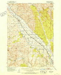
Other maps of this area

1906 · Mitchell Butte
USGS Topo · 1:125,000
1950 · Jamieson
USGS Topo · 1:62,500

1955 · Baker
USGS Topo · 1:250,000

1955 · Boise
USGS Topo · 1:250,000

1958 · Boise
USGS Topo · 1:250,000

1959 · Baker
USGS Topo · 1:250,000

1962 · Boise
USGS Topo · 1:250,000
1964 · Brogan
USGS Topo · 1:62,500
1966 · Harper
USGS Topo · 1:62,500
1967 · Kane Spring Gulch
USGS Topo · 1:24,000