2023 Map of Vintondale
USGS Topo · Published 2023About this map
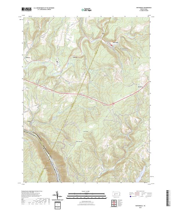
Vintondale and Wehrum anchor this map of a coal-country landscape where the boundaries of Indiana, Cambria, and Westmoreland counties converge. The rugged topography of Laurel Ridge and Rager Mountain is carved by a dense network of waterways, including Blacklick Creek and the Conemaugh River, which flows through the notable Conemaugh Gorge. This modern survey illustrates the repurposing of industrial corridors, notably the Ghost Town Trail, which follows old rail paths past the settlements of Rexis and Dilltown. Genealogists will find interest in the Saints Peter and Paul Orthodox Church of America Cemetery and the Black Lick Cemetery near Clarke Run. The map also captures critical water infrastructure like the Findley Run Reservoir and Big Spring Reservoir, alongside the Potomac Heritage National Scenic Trail as it traverses the mountain ridges.
Find a feature on this map
36 named features on this map. Tap any name to fly to it.
Don’t see what you’re looking for? This feature index may not catch every label — zoom into the map to look around manually.
Map Details
Editions of this 2023 Vintondale Map
This is the sole edition of this map. No revisions or reprints were ever made.
Historical Maps of Jackson Township Through Time
3 maps found

Featured Locations
- Blacklick Township, PA
- East Taylor Township, PA
- Jackson Township, PA
- Vintondale, PA
- Lower Yoder Township, PA