Loading...
Loading map...2024 Map of Wacissa
USGS Topo · Published 2024About this map
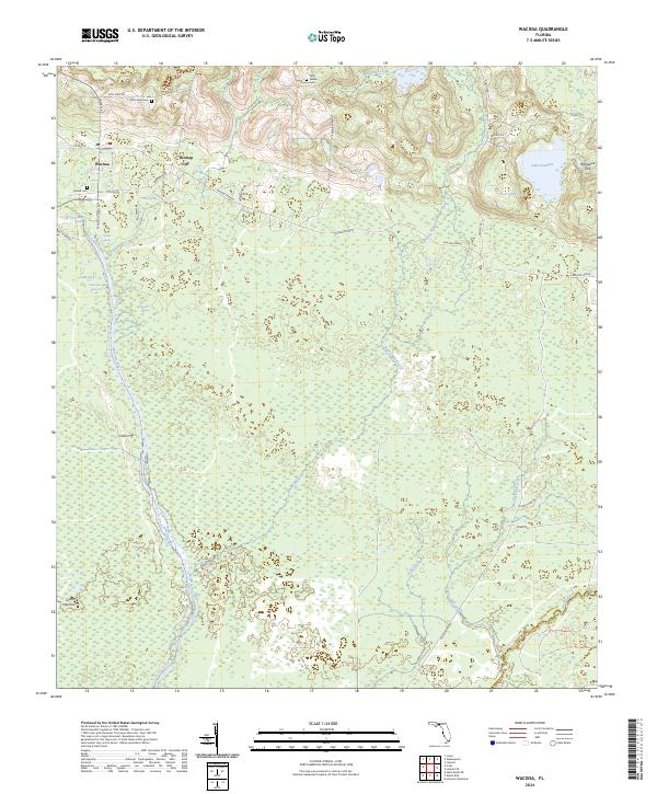
The Wacissa River network dominates this Jefferson County landscape, emerging from a series of freshwater springs such as Aucilla Spring, Little Blue Spring, and Big Blue Spring. The settlement of Wacissa serves as a central point in this wetland-rich region, located just south of Thomas City. The map reveals a complex hydrology where surface water often disappears into the limestone substrate, notably at the Welaunee Sink near Lake Iamonia.
Find a feature on this map
52 named features on this map. Tap any name to fly to it.
Don’t see what you’re looking for? This feature index may not catch every label — zoom into the map to look around manually.
Map Details
Date Portrayed2024
Date Published2024
PublisherU.S. Geological Survey
Map TypeTopographic
Scale1:24000
Physical Dimensions24 x 29 inches
Editions of this 2024 Wacissa Map
This is the sole edition of this map. No revisions or reprints were ever made.
Historical Maps of Thomas City Through Time
Featured Locations
Source Details
SourceU.S. Geological Survey
CopyrightPublic Domain