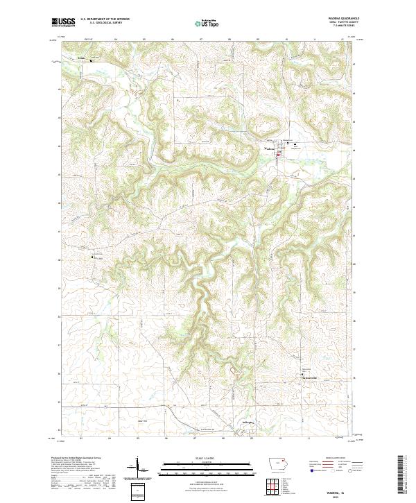
2022 Map of Wadena
USGS Topo · Published 2022About this map
The Volga River carves a winding path through the heart of Fayette County, anchoring a landscape defined by small valley settlements and high prairie ridges. This modern survey captures the enduring rural character of northeastern Iowa, where the river's course is followed by the town of Wadena and the nearby Lima. The map highlights a high density of historical burying grounds, including Saint Josephs Cem and Corn Hill Cem, which serve as vital touchstones for family historians. Further south, the terrain levels out around Arlington, while features like Blue Spring and the heights of Bear Hill offer a look at the natural geography that dictated early settlement patterns. Traces of past communities remain visible at Taylorsville, located at a bend in Brush Cr, documenting the persistence of these rural places.
Find a feature on this map
66 named features on this map. Tap any name to fly to it.
Don’t see what you’re looking for? This feature index may not catch every label — zoom into the map to look around manually.
Map Details
Editions of this 2022 Wadena Map
This is the sole edition of this map. No revisions or reprints were ever made.
Other maps of this area

1901 · Oelwein
USGS Topo · 1:125,000

1959 · Dubuque
USGS Topo · 1:250,000

1961 · Dubuque
USGS Topo · 1:250,000

1962 · Dubuque
USGS Topo · 1:250,000

1965 · Elgin
USGS Topo · 1:24,000

1965 · Wadena
USGS Topo · 1:24,000
1965 · Gunder
USGS Topo · 1:24,000

1965 · Strawberry Point
USGS Topo · 1:24,000

1965 · Arlington
USGS Topo · 1:24,000
1965 · Volga
USGS Topo · 1:24,000